It is with pride and confidence that I and my family can claim a special relationship with the Grand Canyon. I first saw the Canyon in 1964 and was struck speechless by its glorious beauty and immense silence. The many other times I saw the Canyon – most recently in the winter of 2012 and just this past March of 2022 – I was also speechless. The Grand Canyon defies description and understanding. Something so vast and so beautiful inspires and requires reverence and contemplation. Human voices seem sacrilegious and out of place. Smiles and sighs are appropriate.

I have also experienced the Canyon in a way many observers have not – I have hiked, not only down to the bottom and back, but also rim to rim to rim: from the South Rim down, then up to the North Rim; then back to the bottom and up the South Rim again. I have to say that hiking is truly the only way to completely experience the Grand Canyon, to touch it, be enveloped by it, to be surrounded and inundated by its beauty.
Early encounters
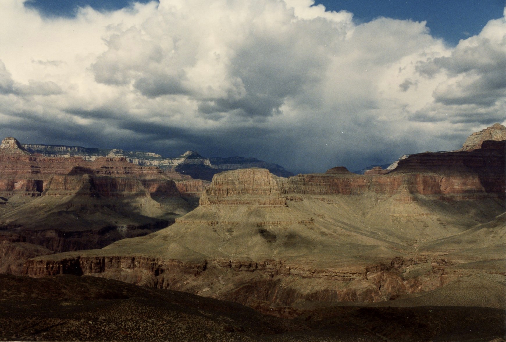
In 1964 I took a two week – 16 days including weekends – summer trip with my then wife Elaine to the southwest, an area of the country which as New Jersey natives, we had never seen. The dry air, hot sunshine and fluffy white clouds against the bluest of skies were new and spectacular, as was the New Mexico and Arizona scenery. Seeing southwestern vegetation for the first time, especially the archetypical Sahuaro cactus in Arizona, was thrilling. But nothing matched the drive steadily ascending the Kaibab plateau, first through piñon and juniper and finally Ponderosa pine and then suddenly the plateau falling away and exposing below us and all the way to the horizon the most beautiful rock formations and colors I had ever seen – the Grand Canyon, certainly one of the greatest, if not the single greatest, natural spectacle on our planet.
We stayed several days, enjoying the Canyon from its many South Rim viewpoints and taking dozens of pictures, the first of hundreds taken over the years. In 1966 we returned to the southwest on another two week road trip and saw the Canyon again and loved it again, wondering how we could move to Arizona permanently to be close to the many natural spectacles in this lovely state, especially our beloved Grand Canyon.
Prior to this second visit, we had read an account in the the New York Times describing the mule trip down to the bottom, lunch at Phantom Ranch and then the trip back up. Accordingly, prior to our car trip we scheduled this event about six months in advance and enjoyed the experience during this 1966 visit. However, we were a bit embarrassed – there we were, two healthy young people in their twenties, riding down and back in a mule caravan passing group after group of fit and suntanned hikers, making us feel a bit lazy and wimpy. Actually though, being a naive easterner I didn’t really realize you really could hike the Grand Canyon at all. Indeed I thought the only way down and back was on these mule trips. Anyhow, that was the first time I had really experienced the Canyon from the inside instead of the top – a great experience, and easy too!
The opportunity to move to Arizona presented itself in 1968 when, after three years of teaching in New Jersey, I responded to a recruitment advertisement my mother had told me about and obtained a teaching job with the Bureau of Indian Affairs first in Pinon and then Rock Point, Arizona from 1968 to 1970. During these two years, we drove all over Arizona and New Mexico to enjoy the many sights and of course, visited the Grand Canyon several more times, enjoying it just as much as the first, and still finding ourselves struck speechless at each visit.
Later visits
After a decade of being single I met Bobbie Keches at my school in Duxbury, Massachusetts, the woman I would eventually marry. On a trip west to meet my parents and brothers, Bobbie and I visited the Grand Canyon for the first time together.


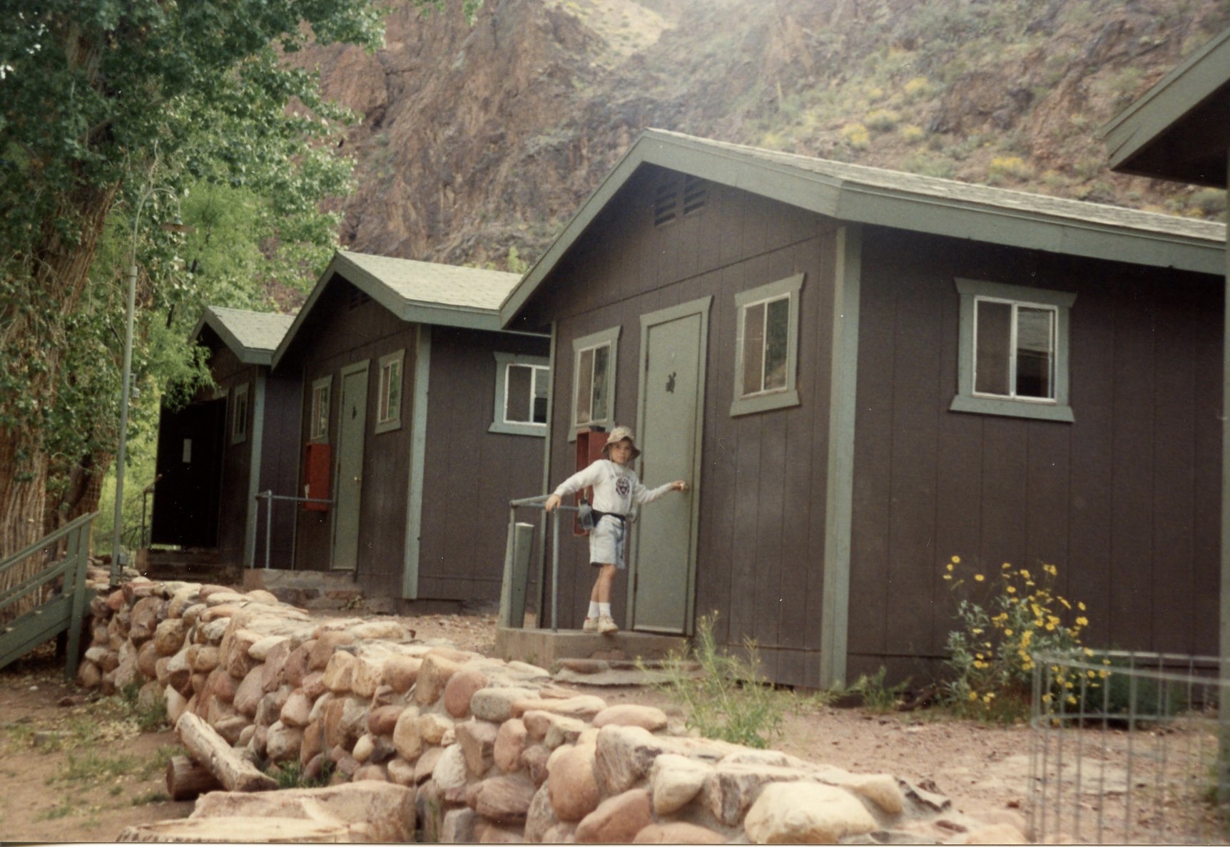
We stayed several nights in one of the rustic cabins in the Maswik Lodge housing area and enjoyed the Canyon from many viewpoints, especially Yaki Point. It was there where we clambered down the dangerous remnants of an old trail or stairway, hanging on to trees, bushes and a few chunks of old rebar and concrete, to a now inaccessible viewpoint, a wide flat promontory about 50 feet below the main viewpoint, upon which was perched a large but climbable hamburger shaped tan rock. Bobbie and I sat on this rock, removed and apart from the Yaki Point view area far above us, drank a couple of cans of Coors as we shared a cheese sandwich and as the sun went down I proposed to her and she said yes.

This special place will always be dear to us and is something we always seek out on all of our trips to the Canyon since, just to take another look. It is of course unchanged from when we sat on it back in 1981 but has now been rendered completely inaccessible by the park authorities. Every trace of what we then employed to climb down is now gone.

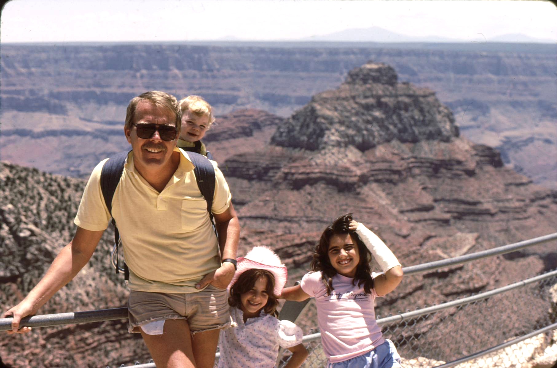
Early in our marriage we took the children to the Canyon several times, including the North Rim. On one trip Bobbie attended an educational workshop scheduled at the Canyon, so of course we all came along. And during that visit, since this was before Park authorities had rendered it inaccessible we could still climb down to “the hamburger” at Yaki Point, our personal little viewpoint. we somehow got the children down also and took some memorable pictures at this special spot where, in 1981, we decided to get married.


Also, there was one time when we traveled to stay several days at the Grand Canyon in the wintertime. In early January when the South Rim was entirely snow covered and very cold, we stayed in the Bright Angel Lodge. Since we wanted to experience a sunrise, we got up before daylight, went to the restaurant and got our thermos filled with hot coffee, bundled up in our down coats and watched the sunrise in the below-zero temperature and sipped our coffee.

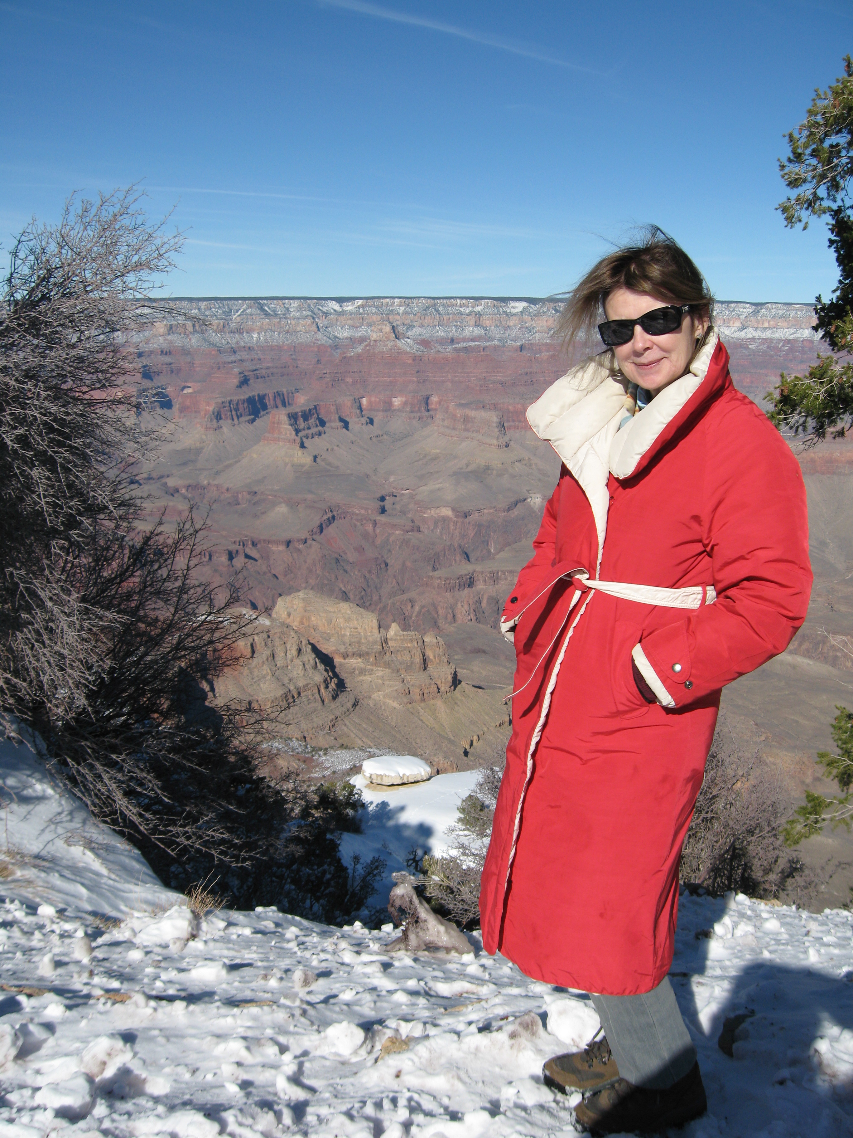
And on one more recent wintertime visit to the Grand Canyon we encountered a rude surprise. The shortest way to the Canyon from Phoenix is to drive straight to Flagstaff from Phoenix on Interstate 17, the take US 180 from there to where it meets State Route 64 which continues north to the Canyon. US 180, it should be noted, ascends to a fairly high altitude as it goes north, leaves the city and skirts the San Francisco Peaks. On this disastrous occasion, we traveled on a snow packed highway, not noticing that there was little to no traffic. We obviously had missed a warning sign of some kind because US 180 abruptly ended at a barrier and a huge pile of snow and a “Highway Closed” sign, perhaps 15 miles north of the city. Accordingly we had to turn around, drive all the way back to Flagstaff and go west on I-40 to the town of Williams and State Route 64, which eventually brought us to our destination, several hours later than we had planned. So on subsequent winter trips to the Grand Canyon, we have assiduously avoided US180 for fear of encountering another such unexpected closure.
First Rim to Rim to Rim Hike
Sometime during the fall of 1989 I learned from my friend and professional colleague Hugh Callison that he and his wife had successfully hiked the Grand Canyon rim to rim to rim the previous year, having been invited by a friend who worked for Honeywell and was a member of a group who took this hike annually on Columbus Day weekend. Having expressed interest, Hugh invited Bobbie and me to join the group that fall. Accordingly, we made reservations for Friday night at Yavapai Lodge on the South Rim and for Saturday and Sunday nights in a cabin at the Grand Canyon Lodge on the North Rim. Friends and spouses not hiking but wishing to join the hikers on the North Rim, would drive there via US 89 and Arizona 67 and bring extra clothing and other equipment. so we hikers did not have to carry much with us.
Hugh had advised us on how to equip ourselves. A fanny pack with water bottles was essential, as were moleskin and small scissors for any blisters that might be incurred. A light nylon warm-up jacket and pants to wear over the hiking shorts for the very cold first part of the hike were desirable, as were flashlights since we would be hitting the South Kaibab Trail before daylight. A good supply of trail mix and energy bars for snacking along the trail were advisable. Also suggested was some ibuprofen to keep the joints from aching too much. And some money for snacks at Phantom Ranch at the bottom.
So, having driven up to the Canyon and staying the night at Yavapai Lodge near the South Kaibab Trail trailhead at Yaki Point, we were up very early, dressed and ready to go at about 4:00 AM. We drove to the trailhead, parked and joined the rest of our group of hikers and began the trip as a procession of twinkling flashlights. Far below us, we could discern the faint moving light of other flashlights from a group or two who preceded us. And as we descended we could also see moving lights far above us from individuals or groups that had began their descent after us.
As the sun rose and it got lighter and warmer, the workout pants and jackets came off and were stowed in the fanny packs or tied around the waist and we could enjoy the sun and breeze in shorts and T-shirts. Hiking down the South Kaibab trail was obviously quite easy since you were going downhill, not up. The only strain was on the thigh muscles, which you stretched since each step was lower than the previous one. Also of course, though easy hiking, blisters still sometimes occurred, requiring a pause to sit on a rock, remove the offending boot and sock, locate the completed or developing blister, cut a piece of moleskin, apply to the area, pull on the sock and boot and get back on the trail.
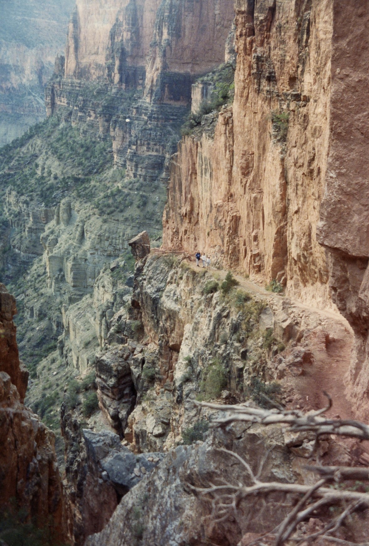
As the sun rose, we were able to enjoy some of the broad vistas of the Canyon, first from Ooh Aah Point where we could finally see the east side of the Canyon and later from Skeleton Point where we could get our first glimpse of the Colorado River, still far below us. Other highlights encountered on the South Kaibab Trail were Cedar Ridge, a wide flat area on the trail which contained some primitive bathrooms and a good look at O’Neill Butte, which loomed before us during a good part of the hike.
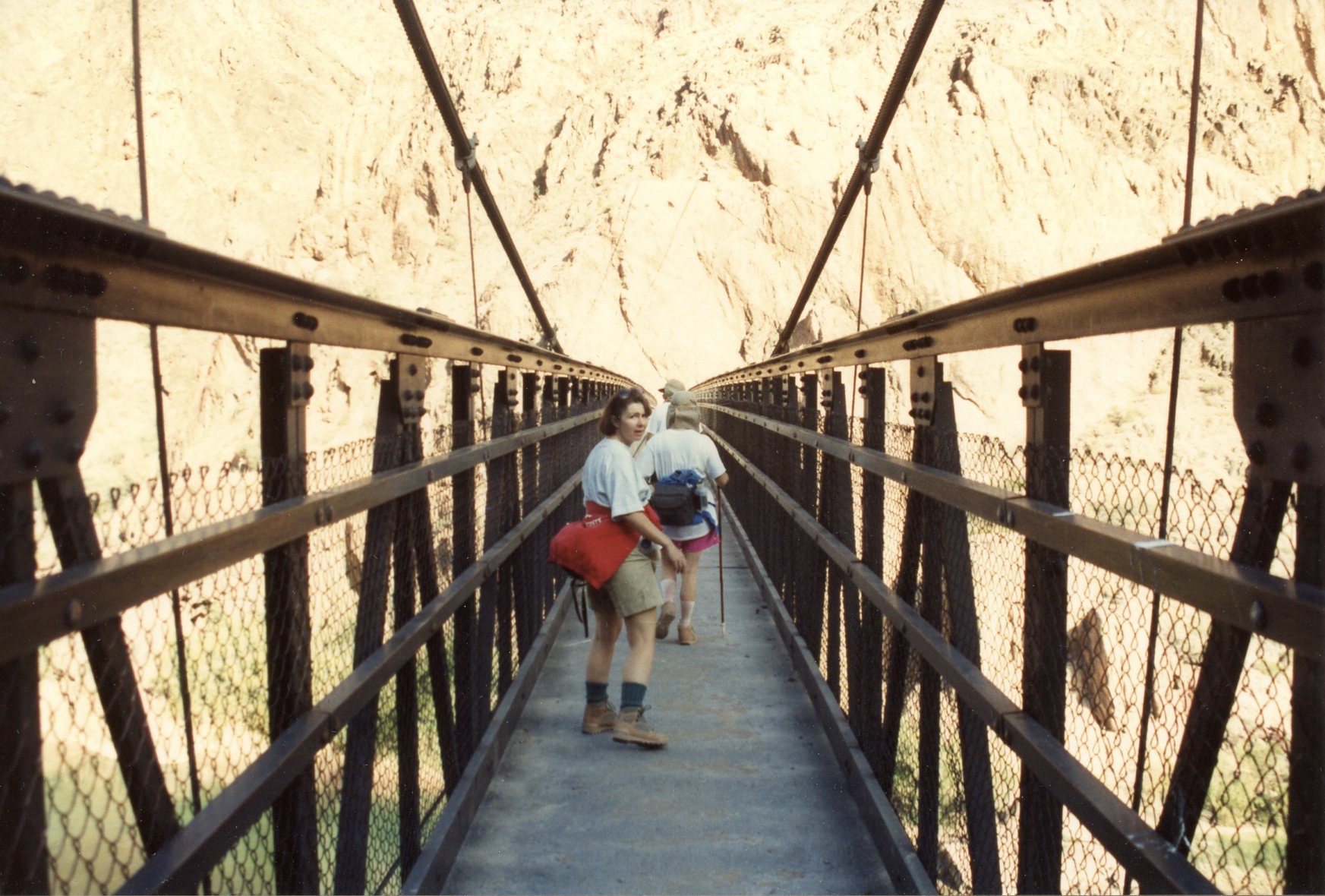
After crossing the suspension bridge over the Colorado River we arrived at Phantom Ranch, the perfect place for an extended rest before the strenuous uphill hike in front of us. Here we bought a souvenir or two, wrote a few postcards for friends which would be postmarked “Phantom Ranch”, munched on a couple of handfuls of trail mix or energy bars, downed a couple of ibuprofen tablets, refilled our water bottles and got back on the trail.

The North Rim of the Grand Canyon is about a thousand feet higher than the South Rim and the North Kaibab Trail is significantly longer than the trail we had just left. It begins at Phantom Ranch and ascends gradually at first on the way to the much steeper trail up the North Rim. Our first rest stop was at Ribbon Falls, about five miles up the North Kaibab Trail. After hiking through “the box”, where the trail goes through the black Vishnu Schist, a metamorphic rock that is some of the oldest exposed rock on the face of the earth, and a very hot part of the trip – low altitude, dark color and little exposure for a cooling wind or breeze.
A short hike on a minor trail to the west brought us to the falls, a lovely area at which a fairly substantial stream falls about 60 feet onto some beautiful moss-covered rocks. Behind the falling water is shady and cool, a great place to grab a snack, drink some water and rest a few minutes before returning to the the main trail and resuming the hike up to the North Rim.

Continuing the hike, the next rest stop was a campground called Cottonwood which provides tent sites for hikers wishing to camp overnight and provided us day hikers with water with which to refill our canteens, some picnic tables at which to sit for a short rest and basic toilets if needed. So after a short stop it was back on the trail for the last seven or so miles to the North Rim.
Now, tired from the hike down to Phantom Ranch and over to Ribbon Falls and back, these last miles are the most arduous of all, with the trail becoming steeper and steeper. At one point the hiker has the opportunity for a detour to Roaring Springs, the point from which the pipeline for bringing water to the South Rim originates. You can hear the water – it’s not called “roaring springs” for nothing – and imagine what it looks like but I have never taken the short trip off the main trail to see it. I’ve always been too tired for a detour and trying to save the rest of my energy for the remaining uphill miles.
A few other highlights of this part of the north rim hike bear mentioning. First, there is the “red wall” part of the hike, where the trail is blasted from a sheer wall of red rock. Above one sees hundreds of feet of smooth rock, and the same looking down. And needless to say, the views from anywhere on this part of the trail are spectacular.
And another section of the trail is especially vexing because, as you are heading up the steep trail, praying that you’ll have the strength and stamina to keep putting one foot ahead of the other, and thankful for every foot of altitude gained toward reaching the rim, suddenly you find the trail going downhill, sacrificing and effectively erasing much of that progress. Yes, the trail actually descends, in order to cross the Red Wall Bridge, built over the chasm created by Bright Angel Creek. After crossing the bridge, the trail ascends again, regaining the altitude you just lost, and taking you steadily up the remaining 3.5 miles to the trailhead.

Another landmark on the trail is the Supai Tunnel, pleasant to go through because its passage means you are just 1.7 miles to the top, although a rather daunting 1385 feet in altitude. Also, going through the tunnel, although quite short, takes you from the desert-like landscape of the Canyon proper to the lush vegetation and forest of the North Rim. The tunnel marks the terminus also for the North Rim mule trips, which unlike mule trips from the South Rim, do not take the rider to the bottom of the Canyon. And the amount of mule manure and urine deposited on the floor of the tunnel provides ample impetus for the hiker to get through quickly.
Finally at the trailhead after your exhausting hike from the South Rim via South Kaibab Trail to the North Rim via North Kaibab Trail, you are not yet home. It is approximately two miles from the trailhead to the North Rim Lodge, where presumably a nice dinner and a much needed night’s sleep are waiting for you. Most hikers, our groups included, usually have non-hiking friends or spouses driving around to the North Rim ready and willing to meet you at the trailhead and give you a welcome lift to the Lodge.
On this first 1989 rim to rim to rim hike, after dinner at he lodge, the welcome day’s rest, another restful night’s sleep in our cabin, and the long hike downhill to Phantom Ranch, Bobbie and I decided to return to the South Rim via the less steep but significantly longer Bright Angel Trail. Hugh and Nina Callison and the rest of their party had returned the same way they came, on the South Kaibab Trail and drove to the trailhead to help celebrate our last few yards up the trail and memorialize the end of this adventure with a photo. With that one day’s rest in between, we had hiked over 44 miles down and up both directions during this first Rim to Rim to Rim experience.

General Notes and Observations
I should parenthetically note some other aspects to hiking the Grand Canyon. About the trails – the main ones are Bright Angel Trail and South Kaibab Trail on the South Rim and North Kaibab Trail on the North Rim. There are other minor trails that are frequented only by more experienced and daring hikers but generally, when you “hike the canyon” these are the trails you use.
When deciding which South Rim trail to take either up or down, the potential hiker needs to consider some serious differences between the two. Since it is longer, 7.8 miles from the Rim to the Colorado River plus a hike of an additional mile or so along the River to Phantom Ranch, the Bright Angel Trail is not as steep as the South Kaibab trail which is 6.3 miles. Also Bright Angel starts out a little lower in altitude, descending 4460 feet to the River, while the South Kaibab descends 4800 feet. In addition, it should be noted that the views are better from the South Kaibab trail because the trail mostly follows ridges and promontories and trail segments cut into cliffs, while Bright Angel follows stream beds and other more natural courses. Obviously this means that the hiker is exposed to the sun and the elements on South Kaibab trail but hikes in significantly more shade on Bright Angel. One more serious difference is that the South Kaibab trail is the main route for the mule trains which carry day trip passengers between the South Rim and Phantom Ranch and which carry supplies down to and waste materials up from Phantom Ranch. And the rule for hikers when overtaken by or meeting a mule train is to stand on the outside edge of the trail, allowing the mules to traverse the inside, quite frightening when there may be a significant sheer drop from the outside of the trail. Also of course, since both the South Kaibab and upper segments of the North Kaibab serve as mule routes, there is the problem of avoiding the considerable manure on the trail. A final major difference between the trails is that Bright Angel has several shaded rest stops along its length, including Indian Gardens, where water may be obtained. South Kaibab has absolutely no water and the only shade is that occasionally rendered by the attitude of the sun on the cliffs cut into by the trail.
Another parenthetical note about hiking the Grand Canyon that might be useful is to mention how different canyon hiking is from mountain climbing. When you hike to the top of a mountain and return in one day, the first part of the journey, the ascent, is quite strenuous and you become exhausted but can look forward to the return when you are descending which is comparatively quite easy and much quicker: tough part first, easy part last. But in canyon hiking, the first part is deceptively easy – you can truthfully say – wow, that wasn’t bad at all. But now, the really difficult part of the journey is still ahead of you – getting back to the top: easy part first, difficult part last – just the opposite of climbing a mountain. And generally speaking, a descent of either a mountain or canyon is usually about twice as fast as the ascent.
Another factor worth remembering, especially where the Grand Canyon is concerned, is the temperature differences between the rim and the bottom of the Canyon. Beginning a summertime hike in the deceptive coolness of the 7000 foot altitude of the Rim, becomes an over 100 degree ordeal at the bottom. That’s why our rim to rim to rim hikes were always scheduled in the fall, to make the bottom temperature tolerable. Really, going from the rim to the bottom is like going from Flagstaff, Arizona to Phoenix, Arizona in climate difference – about 30 – 40 degrees.
Another note is that it’s wise to take one or two “tuneup hikes” on some other canyons or mountains before attempting hiking the Grand Canyon, either down and up one of the South Rim trails or definitely attempting to hike rim to rim to rim. Such preliminary hikes can stretch out and strengthen the thigh and calf muscles which will be sorely stressed on the real hike and make the inevitable soreness after the Grand Canyon hike much more tolerable and less debilitating.
1990 Hike with Conrad
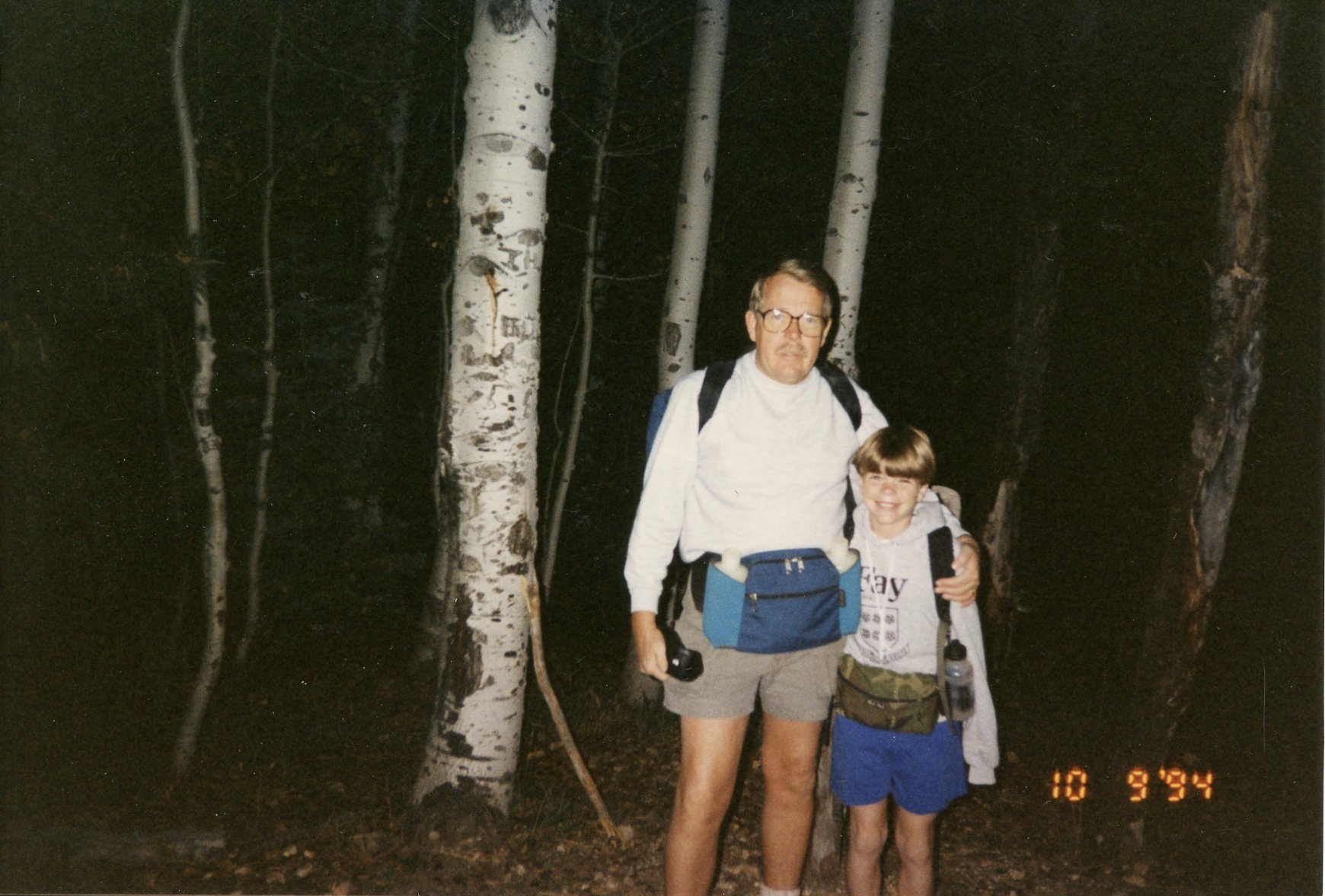
One of the highlights of a long and happy relationship with my son Conrad was the Grand Canyon hike we took together, just the two of us, in 1990 when he was almost eight years old. We had reserved a night at the Bright Angel Lodge and two nights at Phantom Ranch in the bottom of the Canyon near the Colorado River. As I recall we had scheduled this event during the still cool weather of the April spring break.
We began the trip with a leisurely sight-seeing jaunt through Flagstaff and environs, including some clambering around the huge cinder beds near Sunset Crater National Monument and a stop to inspect the spectacular ruins at Wupatki National Monument on the way back out to Highway 89 north of Flagstaff. The Sunset Crater area is quite interesting – most prominent is the crater itself, a readily recognizable cinder volcano cone, surrounded by wide areas of cinder mixed in with a few other dormant volcano remnants. When I had first seen Sunset Crater, tourists were allow to go up to the rim of the crater on a long cinder trail which wound up the cone. But since the annual army of hikers had caused significant erosion the trail was closed in 1973.
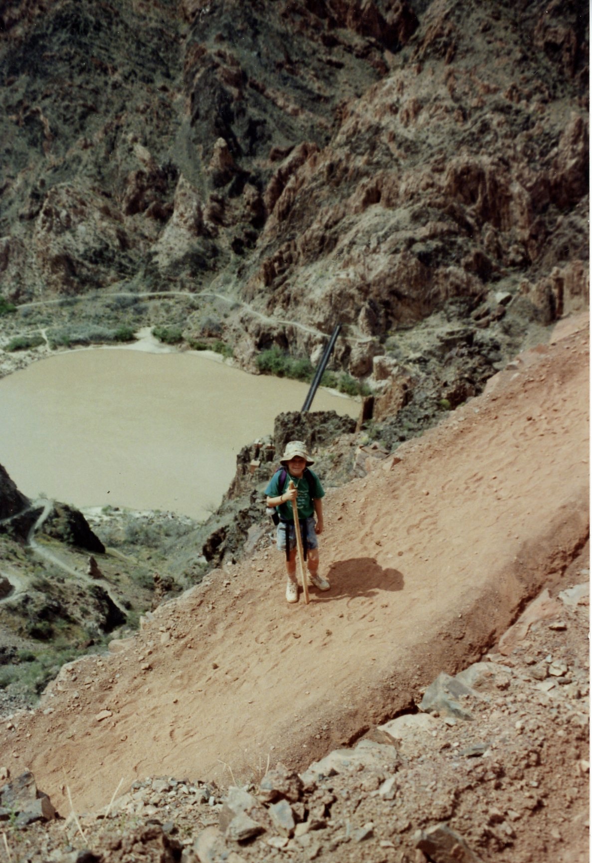
On the morning of the hike itself, we took it easy and bought a nice hat and a walking stick for him at the Bright Angel Lodge store. On this particular morning, contrary to the rim to rim hike I had taken, there was no particular hurry. We only needed to get down to Phantom ranch in time for dinner. The only thing we had to carry was our fanny packs with some snacks and water, and our backpacks with changes of clothing for our stay at Phantom Ranch. So we drove over to Yaki Point to the South Kaibab trailhead, parked the car and started our journey.

The trip down was, as always, spectacular. The South Kaibab Trail takes the hiker down into the canyon on a route with perpetually great views. The other major South Rim trail, Bright Angel Trail, which I have only taken once, on the return trip up from the Canyon on my first rim-to-rim hike, takes a more gentle but longer route, one which follows a number of stream beds in smaller branch-canyons, thus limiting the hiker’s views. In contrast, the South Kaibab is cut into canyon walls and follows ridges and promontories, thus the broad views of the grandeur of the Canyon. But the South Kaibab is definitely steeper and more of a physical strain when going up; however, I have always claimed the the more severe grade is balanced by the fact that it’s significantly shorter.

We enjoyed our hike down, pausing for drinks and snacks occasionally and to take some pictures. After crossing the suspension bridge over the Colorado River, we made it to Phantom Ranch well before the dinner hour, so after registration we were able to stroll about and enjoy some of the scenery there at the bottom of the Canyon. After a marvelous steak dinner, we went to bed early and after our hike down, slept well. At bedtime we encountered a thin old gentleman who had just arrived, having hiked the latter part of his journey in the darkness. It turned out that he has been “hiking in the dark” for a number of years, enjoying the pronounced silence of the Canyon at night. He was quite elderly, which really impressed us. I of course hoped to be still hiking the Canyon when I got to be his age.
The next day after breakfast was served in the Ranch dining room, Conrad and I availed ourselves of the delicious box lunch provided by the Phantom Ranch kitchen, put them in our backpacks, filled our fanny pack containers with water and hiked the five plus miles on the North Kaibab Trail to a beautiful spot – Ribbon Falls. On our rim-to-rim hikes, a detour to this lovely area off the main trail was a requirement for it is truly a magical spot. A good sized stream flows over the edge of a small canyon wall, falls about 60 feet and sprays a magical “ribbon” of water on huge moss-covered rocks.

Although a “day hike” from Phantom Ranch, the trip is fairly strenuous. Even though the trail appears flat, there is a gradual but significant increase in altitude of about 1200 feet. Also, in going to Ribbon Falls one will have traveled about one third of the way to the North Rim in distance, although certainly not in altitude or difficulty. Also, the first three or so miles on the trail takes you through “The Box”, the area walled in by the black Vishnu Schist at the bottom of the canyon that retains much heat.

Eventually, we arrived at the falls, climbed about, took some pictures and found a nice cool spot behind the falls to sit on some rocks and have our lunch. After lunch we hiked back, a total distance of about 11 miles, mostly through “The Box”, so we were quite tired and took a little rest on our bunks before dinner. However, poor little Conrad, having hiked down the South Kaibab trail the day before, and endured this 11 mile hike the day after he arrived, fell into a deep sleep from which I chose not to rouse him. So I went to dinner alone, ate my steak took most of his meal back to the bunkhouse for him but he never awoke until the next morning.
The next day he was feeling great so we had a big breakfast and began our hike out, again on the South Kaibab Trail. We got to our car at the Yaki Point parking lot at about three that afternoon and headed back to Phoenix, flush with pride and pleasure at what we had accomplished and shared. This trip will live in my memory as one of the greatest things we ever did together as father and son, among many.

Other Experiences
Several of our rim-to-rim-to-rim hikes were made memorable by certain conditions or incidents. On one such hike, I cannot remember the year or any other distinguishing features, I realized with horror that I had forgotten my hiking boots and would have to hike the Canyon in the sneakers that I had worn for the trip. Ordinarily this would have been no big deal if the sneakers had been of better quality and provided adequate support for my feet. As it turned out, while I could feel no pain or abnormality while hiking, after the hike, I discovered that I had seriously injured my feet by not having the sturdy support usually provided by quality hiking boots. A visit to a podiatrist revealed that I had developed plantar fasciitis and was fitted for custom orthotics which, after wearing for a few months, healed the foot problems. This experience forever underscored for me the importance of wearing appropriate footwear while hiking.
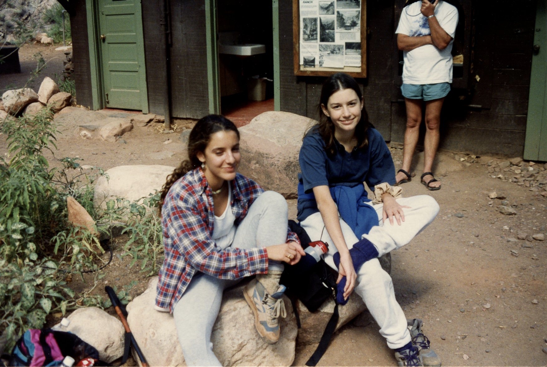
Over the years we took scheduled these hikes, our group’s membership evolved, taking on an identification of its own instead of Honeywell’s. On several occasions, superbly conditioned Washington School District teacher and tennis friend Adrian Young, accompanied us. Adrian usually led the way, literally bounding down and up the trails and always arriving first at the destination. My then teenage daughter Katharine, once accompanied by lifelong friend Jennifer Tryon, then on another hike, by school friend, Tiffany Viehmann. and son Conrad, seasoned by his first hike to Phantom Ranch and back in 1990, came along several times as well on the entire rim to rim to rim hike. Bobbie came along once or twice more as well.


On another rim-to-rim-to-rim hike, this one as I recall in 1993, we were hit with something never experienced before or since on these hikes – bad weather. Generally we could always count on reliably sunny days for these hikes – the only problems being the frigid start of the hikes because of cold early morning temperature on the South Rim, the heat reflected off the walls of “The Box” when beginning the trek on the North Kaibab Trail from Phantom Ranch, and the steadily declining temperature as one began the steep ascent up the last several miles of the trail, accentuated by the exhaustion and energy drain one feels toward the end of the hike, when cold in felt most keenly.
But on this particular hike, which included the Callisons, a friend of theirs, son Conrad, then 10, colleague Adrian Young, and, for the first time, my close friend, art teacher and tennis partner Joe Arpin, it clouded up and began to rain as we began to ascend the more difficult parts of the North Kaibab Trail. Our already tired legs had to lift boot-clad feet, now made significantly heavier by mud adhering to the soles, and the rain on the mule manure on the trail changed this normally dried and unconcerning material to a sticky, noxious mess. There was some relief from those conditions on certain better-protected parts of the trail, including the Supai tunnel, but we got steadily wetter and colder as we ascended, presenting the very real danger of hypothermia for some of us. And to add insult to injury, the rain became flurries of cold snow that evening, though accumulation was insignificant.
This time Bobbie had chosen not to hike, lucky her – she stayed dry and warm – and met us, along with Adrian’s wife Kathy and son Aaron who had also driven around, cold and wet at the trailhead with nourishing drinks and the prospect of a warm ride to the North Rim Lodge. After two nights, a full day of rest and clearing weather, most of us were ready for the hike back with the exception of Joe, who chose to hitch a ride with Bobbie on her drive back to the South Rim to meet us at the end of the day.
Every time I hiked the Canyon rim-to-rim-to-rim, I was part of a fairly large group of anywhere from six to a dozen people. And since not all spouses hiked, there was always someone driving around to the North Rim, a long four hour drive, to take people’s “stuff” – overnight bags with changes of clothing, favorite coffee pots in the Callisons’ case, snacks and so on. Also these other people, whoever they were on a particular occasion, were kind enough to greet us at the trailhead, when we were exhausted and freezing cold, the sip of hot chocolate or the gulp of whiskey provided was most welcome. For actually, when you finally emerged onto the level ground of the North Rim trailhead after an exhausting day of 22 miles down and up, there were still a couple of miles up the paved highway to the lodge, so we hikers were so thankful to be sitting in a warm car, truck or van sipping something reviving and giving our feet and legs a rest.
But on one such hike, with my son Conrad in 1994 when he was 12 years old and I was 52, there were just the two of us. There was no one driving around to the North Rim so we had to carry much more that we were used to – not only our fanny packs with water containers and snacks for the hike, but backpacks as well with our extra clothing, socks, underwear and so on for our two nights and a day at the North Rim Lodge. Furthermore, there was no one to meet us, once we staggered up those last few yards on the trail, totally exhausted and freezing cold. So we had no choice but to head up the paved road to the Lodge where we had a cabin reserved and hold out our thumbs for the several cars that passed us. But no one stopped so after this brutal hike we had to walk an extra two miles in the waning light and waxing cold, and got to the lodge just when it got completely dark. Unbelievable.
However, after a dinner at the Lodge restaurant and a relaxing day the next day, we were ready for the long trek back. But this time we sought the help of some other hikers we met and obtained a ride to the trailhead at 5:00 AM. So we rode in the back of someone’s pickup truck huddled against the cold to the trailhead. But at least we rode and didn’t have to walk. The hike back was uneventful and although daunting, from the North Rim to the South is lots easier than the other direction – more of the miles are downhill rather than uphill. We found the car parked in the space in which we had left it. I produced the car keys from somewhere and we drove back to Scottsdale. This was the last time Conrad or I hiked the the Grand Canyon.
Now finally finishing this article – the most difficult part of which was locating the proper photos out of hundreds taken at the Canyon over the years, I am now 80 years old. I am in relatively good health and sometimes I am tempted to do this hike again. But the nightmare of something happening to me – failing limbs or muscles, a fall or tumble, something broken and the required helicopter rescue that makes the local evening news, has been an emphatic deterrent. At this point in my life I am content to simply and fondly remember and relive these Grand Canyon adventures through simply sitting here, writing about them and looking at pictures. I will leave additional hikes, whether simply down and back or rim to rim to rim, to other family members with younger, more pliant and dependable limbs, like my veteran Grand Canyon hiker spouse Bobbie, eight years younger than I, or an equally seasoned and skilled hiker, our son Conrad.
Addendum
Bobbie and I just returned from our most recent trip to the Grand Canyon. Although Bobbie and daughter Katharine and granddaughter Valentina had met Conrad on a brief trip to the Canyon for Mothers Day in 2015 (I think I was already at out summertime home in Vermont) this was the first time for me in a dozen or so years.
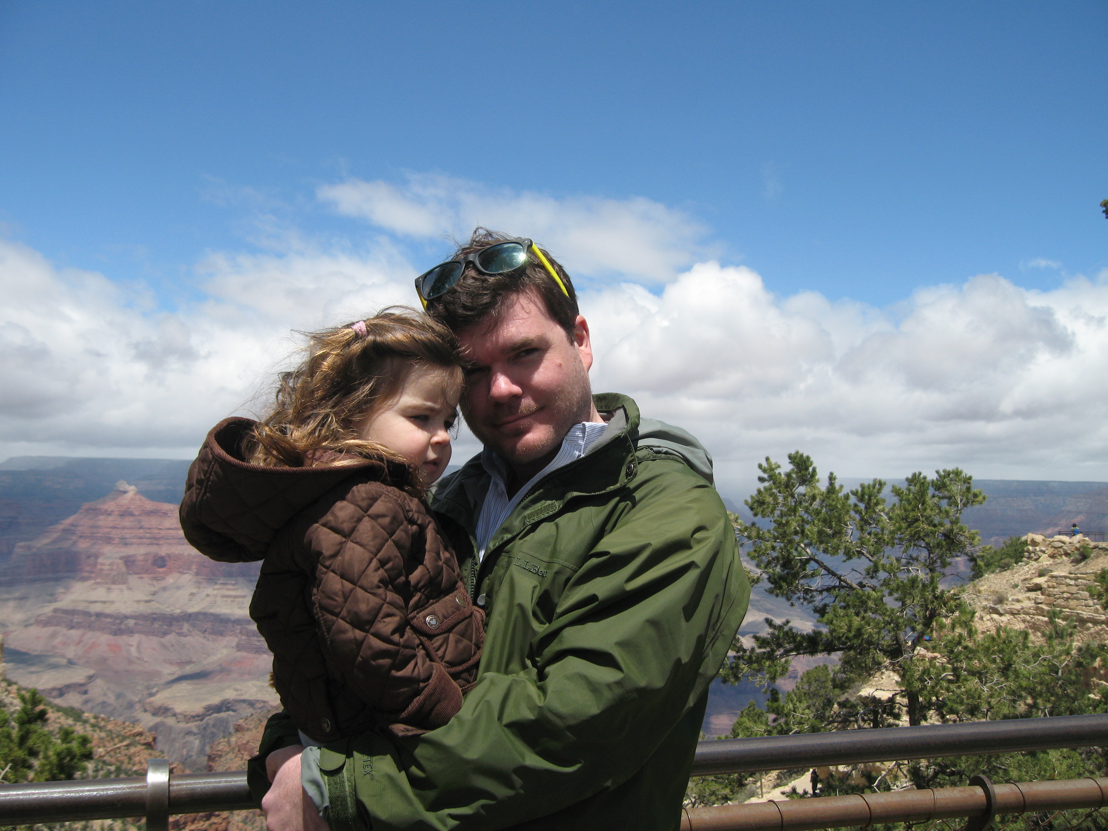
Our first glimpses were thrilling of course. You have to “listen to the silence” of this great natural wonder and always hope and pray for similarly inclined observers looking on with you. And again, so amazing for that time of year, early March, with daytime temperatures barely above freezing and a strong wind blasting through our light jackets, virtually all the viewpoints were quite crowded. And we had to take one of the every fifteen minute buses from the Park Headquarters to many of the viewpoints and to enjoy the view from our favorite spot, Yaki Point.
And yes, as expected, there was our oft-noted promontory just below us, where back in 1981 Bobbie and I had decided to get married and where a few years later we had taken some lovely shots of the children. Well, what did I expect – that the slow passage of geologic time had finally eroded it away after just 41 years, after it had doubtless been there for thousands of years and will likely be there an equal amount of time hence? No, it was there alright and all the memories of what had occurred there so long ago, came flowing back readily. But, amazingly, there was one significant change – a small tree which was not there forty one years ago, nor any of the times we had seen it since, was growing upon the promontory.

Accordingly we walked around Yaki Point, which is, incidentally, very near the South Kaibab trailhead and a variety of stables for the mules which in warmer weather make the trip with tourists on their backs like Elaine and in 1966 or bags of provisions on their backs to supply the needs of Phantom Ranch from spring to fall as it hosts the many riders and hikers who make the trip down to the bottom, we tried to get a few different shots of our special place. We prevailed on the good will of some fellow tourists to get a couple of shots of us with “our” promontory featured between us.

So as this article makes clear, our little family has indeed maintained a special relationship with this mightiest and most beautiful of all natural wonders on our globe. And if wife Bobbie and son Conrad accord me one of my final wishes and toss my ashes into the Canyon from Yaki Point, the relationship for me will finally conclude in a most appropriate fashion.

wow, after reading this, I feel bad that I have yet to see the Grand Canyon. I don’t think my knees would allow me to do the hike. Glenda and I will have to make it a priority next time we are in Arizona. I have been to Canyon de Chelly three times and Petrified Forest Nat. Park once. Great read! Charlie
Ralph I’ve just read another of your writings, and am feeling better about death….as you must be .. excellent work.